OUR Product
A versatile, fully automatic real time data platform for induced seismicity.
Get BEMIS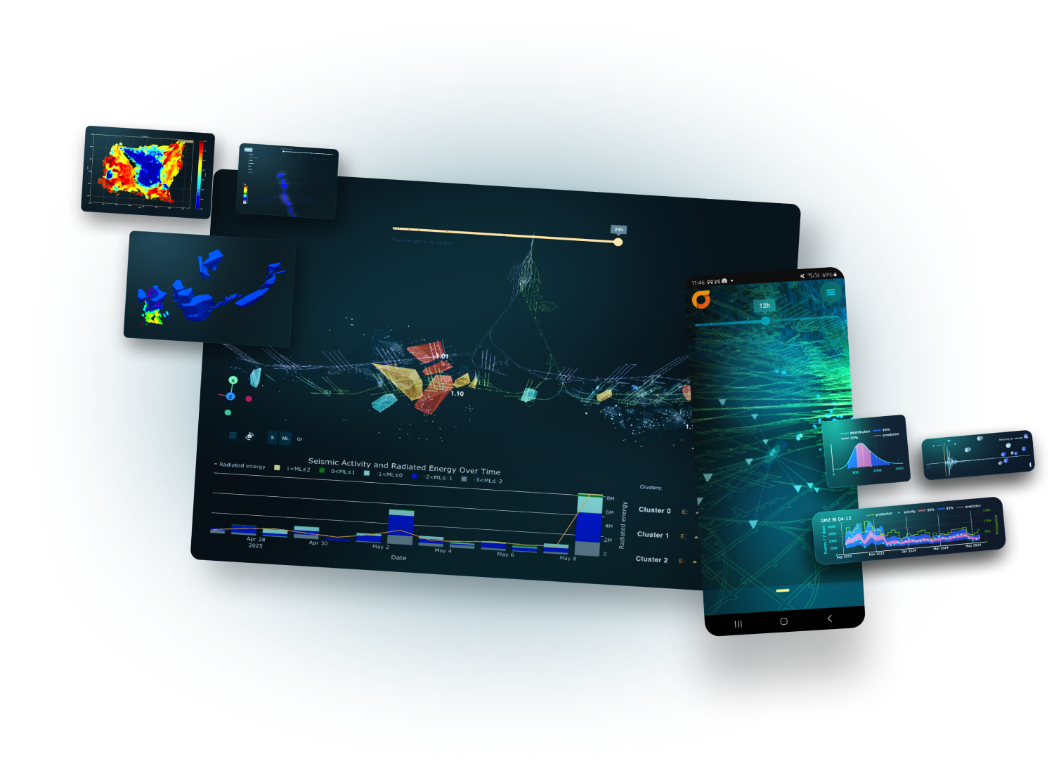
how it works
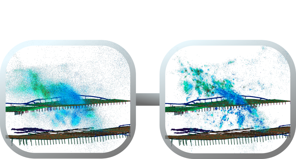
Putting your seismic glasses on
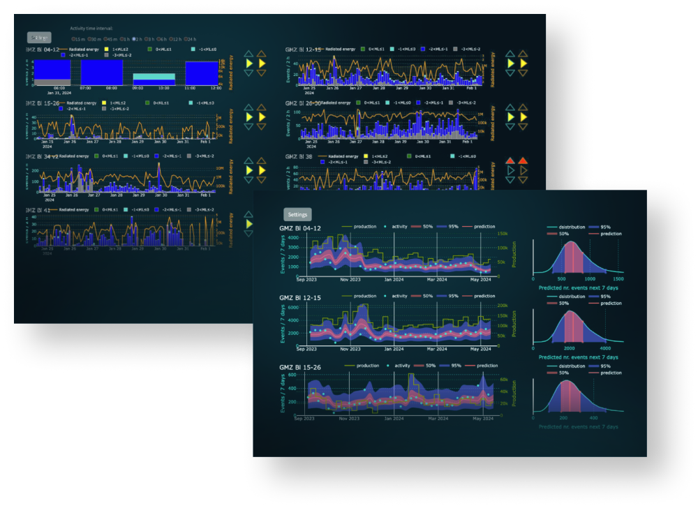
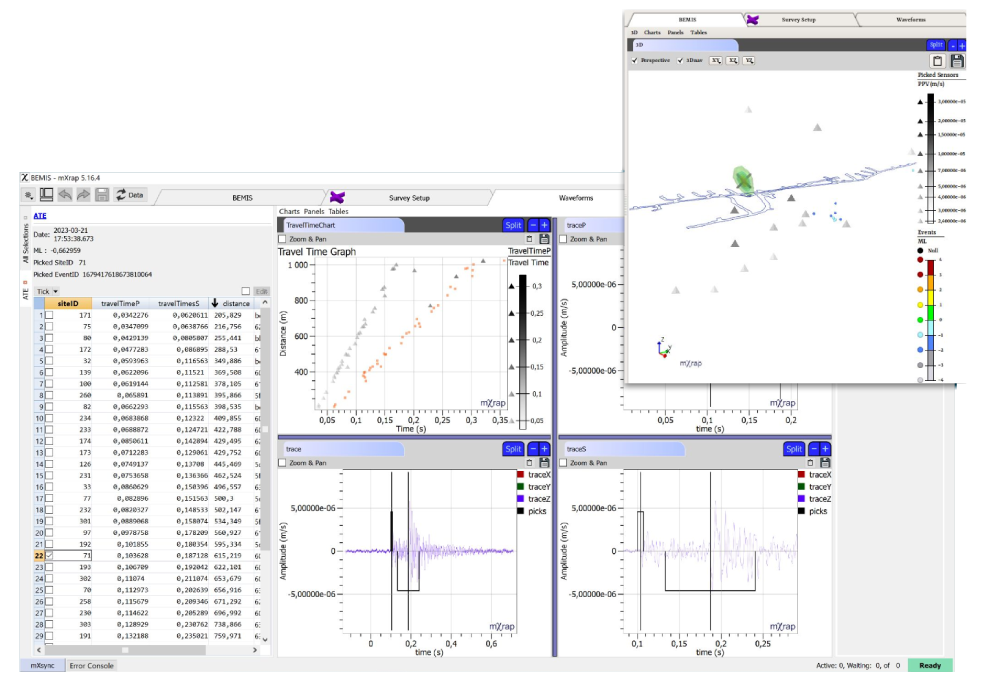
BEMIS’ unique processing algorithms enable far more accurate and precise event locations and distinct clustering, highlighting geological features and production related seismicity.
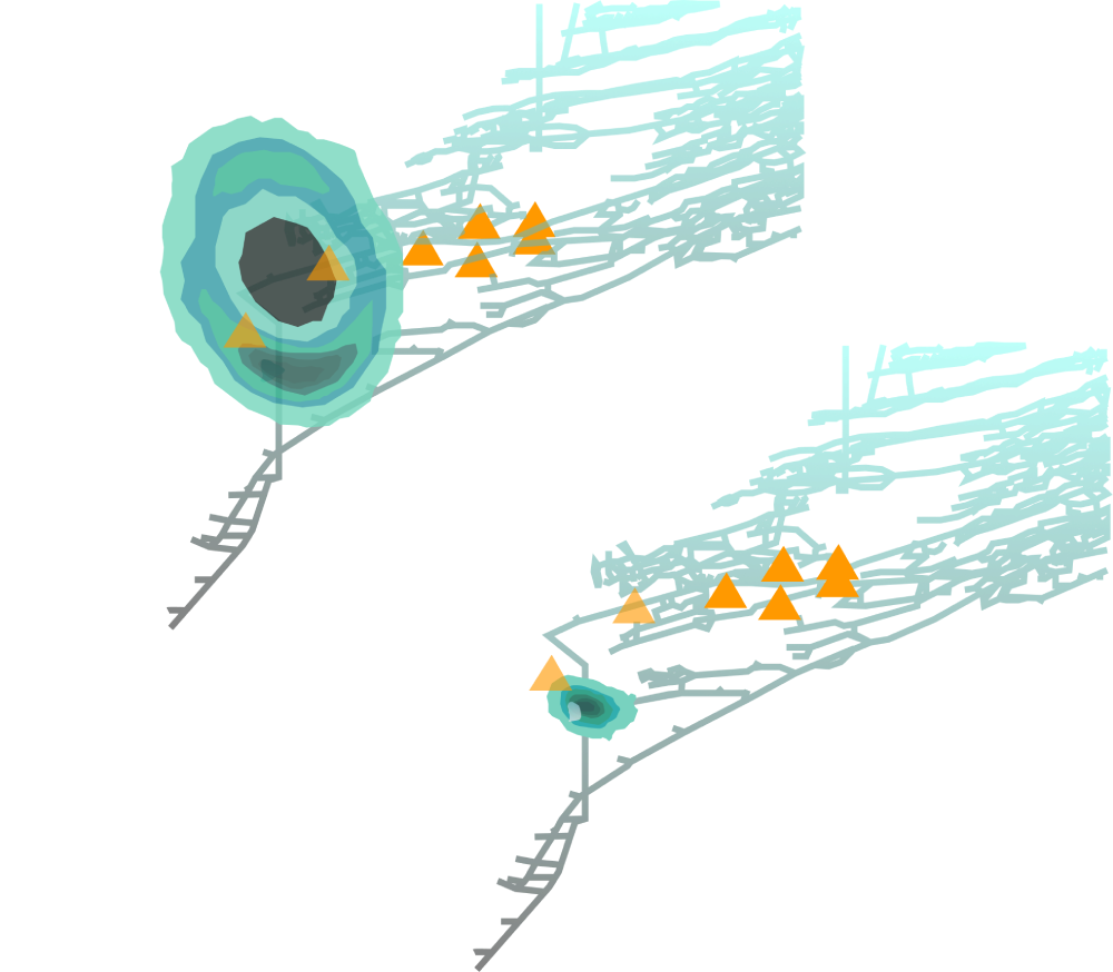
From manual model calibration to data-driven, self-calibrating and adaptive models
BEMIS implements a data-driven and self-calibrating resource (e.g., velocity) model that keeps improving as more data is analysed, and stays up to date with changing rockmass conditions. A high-resolution resource model is key to good location accuracy and reducing location uncertainties.
Make data-driven decisions based on the highest possible quality data
The BEMIS catalogue is an accurate and feature rich data foundation, powering a wide range of specific downstream use cases. Its automated interpretations of high-quality data support high-impact decision making for roles such as ground control engineers, production engineers and mine planners.
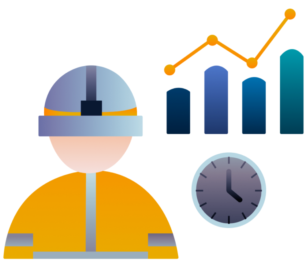
Spend less time on routine analysis and focus more on value-creating priority tasks
BEMIS implements robust and reliable automatic processing with end-to-end data transparency and access to intuitive and easy validation, reducing time consuming manual tasks. This enables engineers to confidently rely on seismic data and focus on high-impact activities.
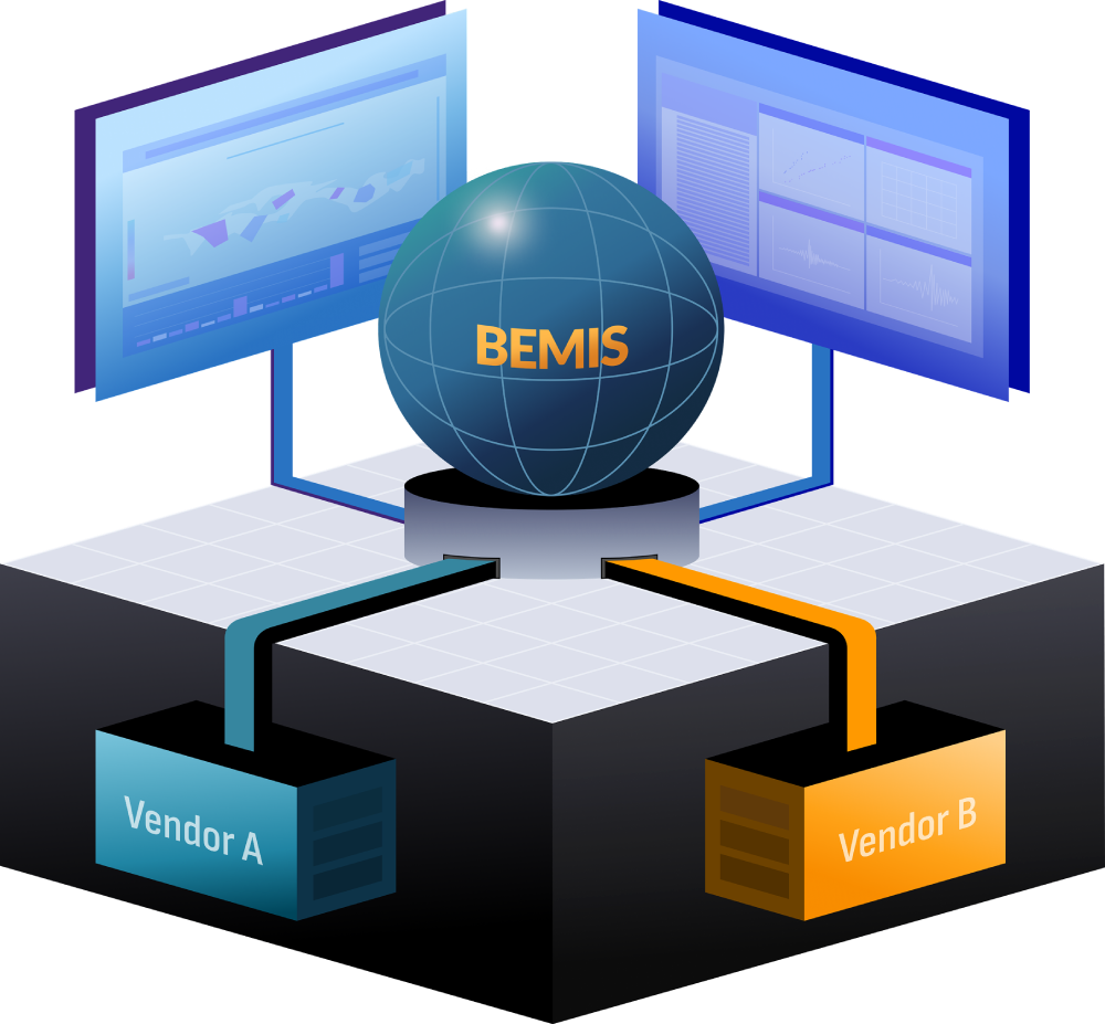
From vendor lock-in to open multi-vendor solutions
BEMIS uses open interfaces and data formats, enabling multi-vendor and multi-technology sensor systems to be unified in a common processing solution and seismic catalogue. Additionally, the seismic catalogue, which is a highly valuable data asset for, is exposed in open interfaces making it available for easy integration with 3rd party applications.
BEMIS TOOLS
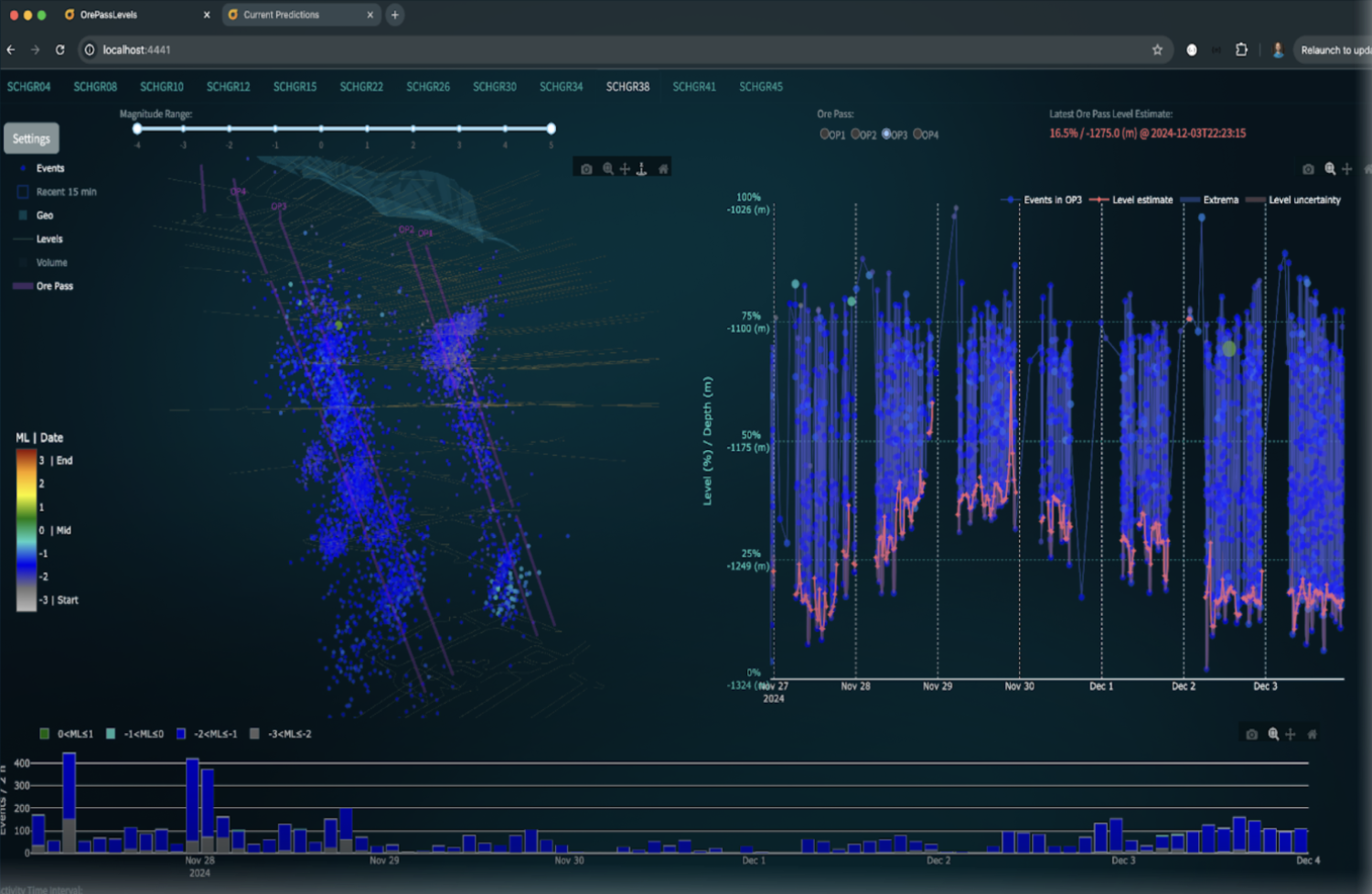
BEMIS’ software ecosystem brings together a range of specialized tools including general real-time seismic monitoring, cluster analysis, tomographic imaging, and more. It also includes production oriented and non-traditional use of seismic data, such as ore pass monitoring.
This modular toolkit ensures that users can address both immediate safety concerns and long-term planning needs, with new updates and features added seamlessly over time.


BEMIS TOOLS
BEMIS TOOLS
THE BEMIS WAY

TECHNOLOGICAL FOUNDATIONS
BEMIS implements Bayesian estimation and robust signal processing methods, applied to geophysic modelling and seismic data processing.
Read publicationsGetting an overview of how our solution could relieve your team’s daily workload doesn’t have to be a big commitment. Reach out to us, and we will happily guide you through everything that BEMIS has to offer.
Contact us